
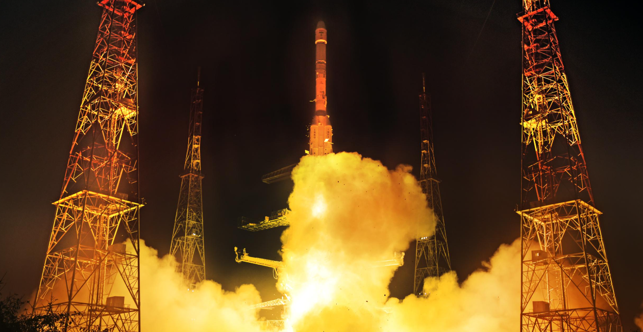
India has successfully launched the new-generation NVS-03 navigation satellite into orbit, which is set to restore full functionality to the national NavIC system. The launch took on particular importance following technical faults with previous satellites, which had left the country unable to provide independent positioning services.
- India has successfully launched the NVS-03 navigation satellite.
- The spacecraft was launched into orbit by a GSLV-F18 rocket.
- The satellite will help restore the NavIC system.
- NavIC is the Indian alternative to the American GPS.
- The NVS-03 is fitted with an atomic clock for precise navigation.
How the launch of NVS-03 took place
Launch vehicle GSLV-F18 It was launched on 30 October at 23:51 local time from the Satish Dhawan Space Centre on the island of Sriharikota.
Approximately 18 minutes and 40 seconds after launch, the satellite, weighing around 2,250 kilograms, separated from the rocket and entered its planned transfer orbit.
This was the 20th flight of a rocket from the GSLV family. The three-stage rocket, approximately 50 metres tall and with a launch mass of 420 tonnes, performed as planned.
Chairman of ISRO Venkata Narayanan confirmed that all the launch vehicle’s main systems were operating normally and that the satellite had been successfully placed precisely into its intended orbit.
The NVS-03 is now due to use its own propulsion system to reach its operational orbit and undergo the necessary checks prior to commissioning.
Why does India need its own alternative to GPS?
The NVS-03 is designed for the NavIC (Navigation with Indian Constellation) system — an Indian regional satellite navigation system that performs functions similar to those of the American GPS, the European Galileo and the Chinese BeiDou.
Unlike global systems, NavIC is primarily focused on India and neighbouring regions. Its coverage area encompasses the country and extends approximately 1,500 kilometres beyond its borders.
The system provides positioning, navigation and precise time synchronisation. These functions are used in various fields:
- road transport and vehicle tracking;
- maritime navigation and the monitoring of fishing vessels;
- surveying, cartography and infrastructure management;
- emergency response;
- military and strategic systems.
Having its own navigation network enables India to reduce its dependence on satellite services provided by other countries. This is particularly important for the defence sector and critical infrastructure, where the availability and accuracy of navigation signals are of strategic importance.
Why the launch of the NVS-03 has become critically important
Throughout 2026, India’s NavIC system faced serious problems due to the failure of some of its satellites.
In July, the Indian government officially announced that only three satellites — IRNSS-1B, IRNSS-1I and NVS-01 — remained operational for determining coordinates.
The system requires at least four operational satellites to determine its position independently. Consequently, NavIC was temporarily unable to provide a fully-fledged independent navigation service, although the time synchronisation function remained available.
Problems also arose with the new satellite’s predecessor — the NVS-02, launched in January 2025.
The rocket successfully launched the spacecraft into space; however, due to a fault with the valves in the propulsion system, it was not possible to manoeuvre it into its planned operational orbit.
In February 2026, ISRO published the findings of its investigation, which concluded that the most likely cause of the malfunction was a fault in the electrical connections within the valve control system.
The new NVS-03 is set to restore the number of navigation satellites to the minimum required of four. The Chairman of ISRO has announced the return to NavIC’s basic configuration, although full utilisation of the new satellite depends on the completion of its commissioning.
What’s new with the NVS-03 satellite
One of the spacecraft’s key features is an Indian atomic clock, which will operate in conjunction with the satellite’s other high-precision clocks.
Such devices provide extremely accurate time measurements. This forms the basis of satellite navigation, as the receiver determines the distance to the satellites based on the time taken for the radio signal to travel.
The NVS-03 also supports a new civil signal for NavIC in the L1 frequency band, alongside the previously used L5 and S signals.
Operating in the L1 band should make the Indian system more compatible with a wider range of navigation receivers, particularly in smartphones and other consumer electronics.
India plans to continue modernising NavIC. The next satellites, NVS-04 and NVS-05, are already at an advanced stage of preparation. Their deployment is expected to enhance the system’s resilience and reduce the risk of a repeat loss of navigation capabilities.